Kananaskis Trail Map 4.0
Continue to app
Free Version
Publisher Description
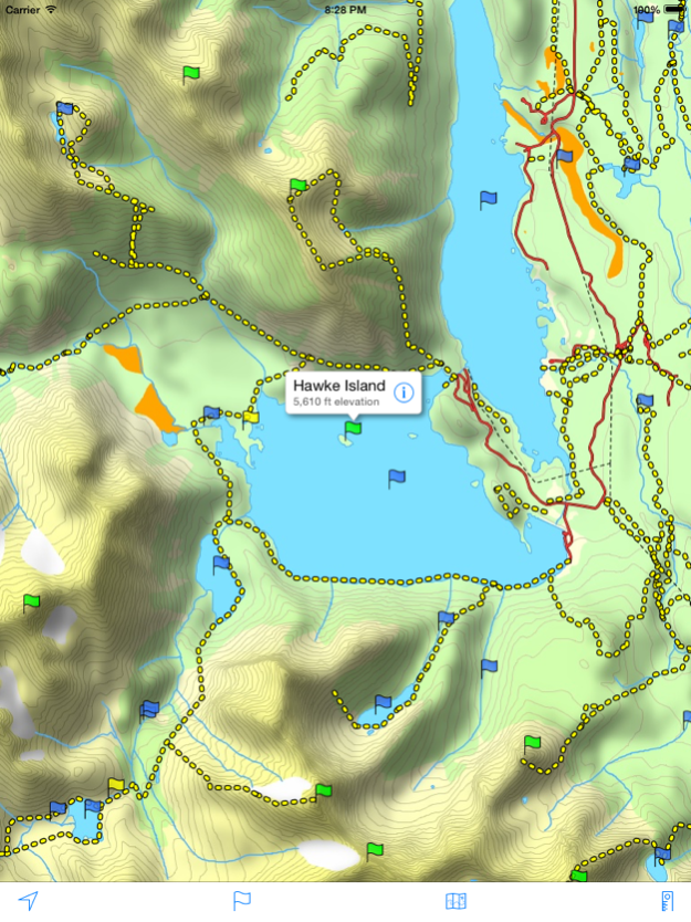
A topographical map of Kananaskis Country, Alberta, Canada.
The trails on the map include Burstall Pass, Chester Lake, Rawson Lake, Elbow Lake, Ptarmigan Cirque, Nihahi, Moose Mountain, and Ribbon Falls.
- Search or browse the names of trails, mountains, lakes, rivers, creeks, and backcountry campgrounds.
- Track your current location and elevation with GPS (on devices with a GPS receiver).
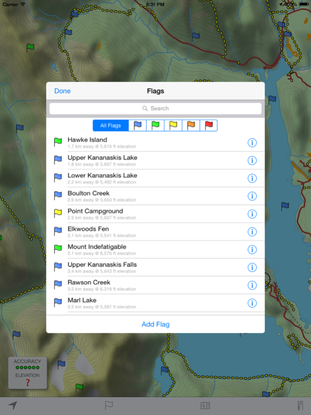
- Add flags (waypoints) to mark locations, including your current location and elevation.
- Share flags with others using email or message.
- Measure distance by sliding finger across the map.
- Use the map with no Internet connection. The entire map is stored on your device.
Note: This is an unofficial map and is not endorsed by the Government of Alberta.
Jun 2, 2015
Version 4.0
This app has been updated by Apple to display the Apple Watch app icon.
- Higher resolution maps
- Additional trails
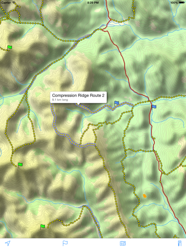
- Trail title and length displayed by tapping anywhere along a trail
- Flag distance and elevation
- Support for iPad and larger iPhones
About Kananaskis Trail Map
Kananaskis Trail Map is a free app for iOS published in the Recreation list of apps, part of Home & Hobby.
The company that develops Kananaskis Trail Map is David Crawshay. The latest version released by its developer is 4.0.
To install Kananaskis Trail Map on your iOS device, just click the green Continue To App button above to start the installation process. The app is listed on our website since 2015-06-02 and was downloaded 5 times. We have already checked if the download link is safe, however for your own protection we recommend that you scan the downloaded app with your antivirus. Your antivirus may detect the Kananaskis Trail Map as malware if the download link is broken.
How to install Kananaskis Trail Map on your iOS device:
- Click on the Continue To App button on our website. This will redirect you to the App Store.
- Once the Kananaskis Trail Map is shown in the iTunes listing of your iOS device, you can start its download and installation. Tap on the GET button to the right of the app to start downloading it.
- If you are not logged-in the iOS appstore app, you'll be prompted for your your Apple ID and/or password.
- After Kananaskis Trail Map is downloaded, you'll see an INSTALL button to the right. Tap on it to start the actual installation of the iOS app.
- Once installation is finished you can tap on the OPEN button to start it. Its icon will also be added to your device home screen.
